Will Modern Tech Change the Future of Cave Exploration
16 min read Discover how modern technology is revolutionizing cave exploration, from advanced mapping tools to robotics, enhancing safety and unveiling hidden subterranean worlds. (0 Reviews)
Will Modern Tech Change the Future of Cave Exploration?
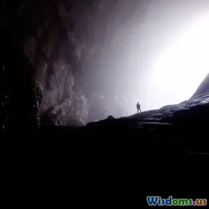
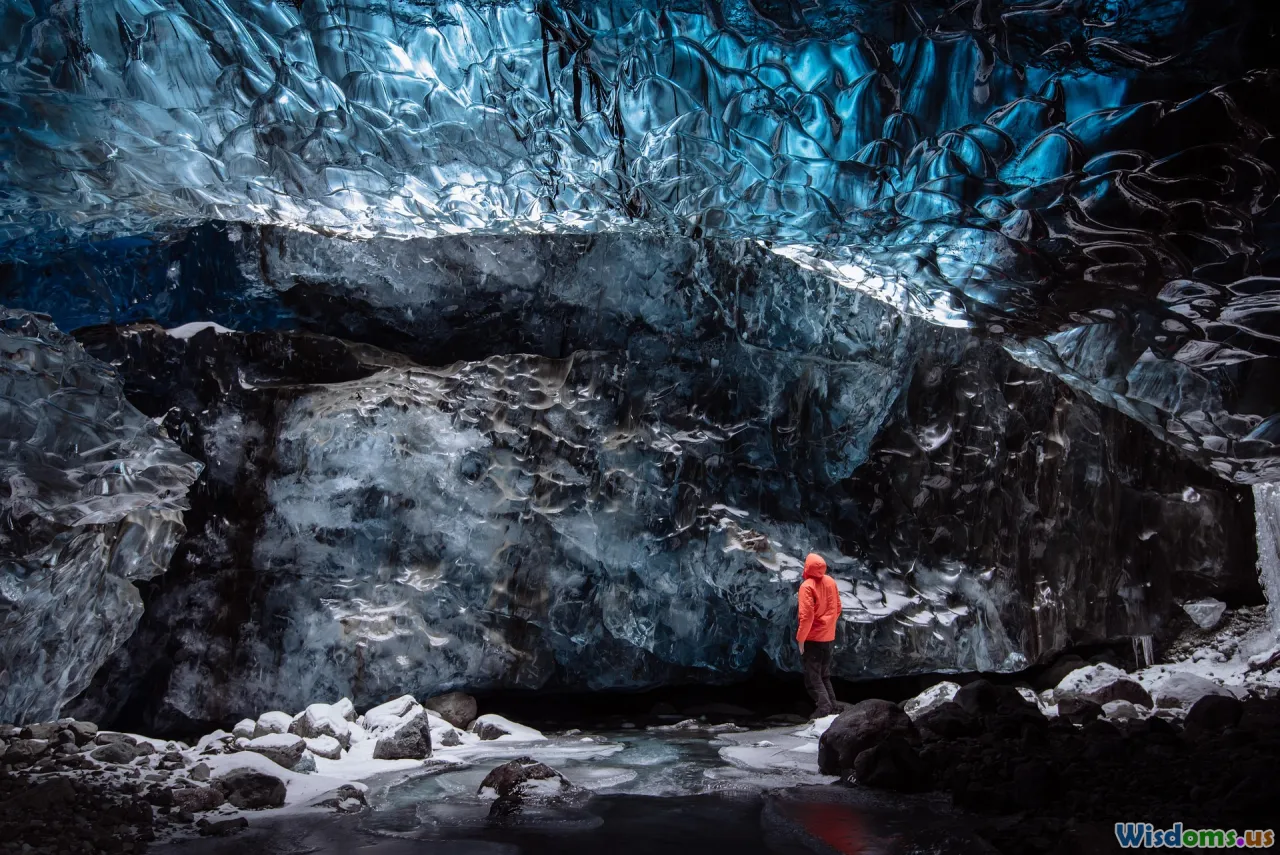
The allure of uncharted darkness has drawn explorers into the depths for centuries. Today, as the frontier shifts from open continents to concealed underground labyrinths, the fusion of modern technology with traditional caving promises to transform both the discovery process and our understanding of these hidden worlds.
From LiDAR scans painting stone cathedrals in flawless detail, to robotics slithering through fissures narrower than the adult hand, tech-driven exploration is already rewriting the rules. But just how deep will these technologies take us, and what new questions do they raise?
Seeing Beneath the Surface: 3D Scanning and Digital Mapping
Before modern advances, cave mapping was painstaking work—measured with compasses, tape, and the explorer’s intuitive sketchbook. This analog legacy is still an essential starting point, but recent years have introduced remarkable new capabilities via 3D digital technologies.
LiDAR and Photogrammetry
Light Detection and Ranging (LiDAR)—which uses pulsed lasers to measure distances—has proved revolutionary in surface archaeology and has found its place under the earth, too. Cavers carry lightweight LiDAR devices (like the handheld GeoSLAM ZEB Horizon) that cast millions of laser points per second, instantly capturing sweeping, hyper-accurate cave interiors. Photogrammetry, a method where thousands of overlapping photographs are stitched digitally, complements this process, filling in visual textures and fine details.
Why It Matters
- Rapid Mapping: In 2022, scientists surveyed Kentucky’s Mammoth Cave (the world’s longest known cave system) with LiDAR and drones, translating months of manual work into a handful of intensive days.
- Preservation: Digital archives protect delicate formations from repeated physical contact and chronic foot traffic.
- Remote Analysis: Experts can now explore digital cave replicas, share them globally, or run simulations, opening the field to specialist input—sometimes without anyone returning to potentially hazardous spaces.
Future Prospects
Imagine a collaboration where every caver worldwide uploads their scans, collectively producing a detailed, constantly updated atlas of global cave systems—an achievable reality as cloud storage and networked databases grow more sophisticated.
Exploring the Inaccessible: Drones and Cave Robots
Some cave corridors are impossibly narrow, flooded, too unstable, or simply deadly for humans to enter. Here, drones and robots are taking center stage, overcoming both spatial and safety limitations.
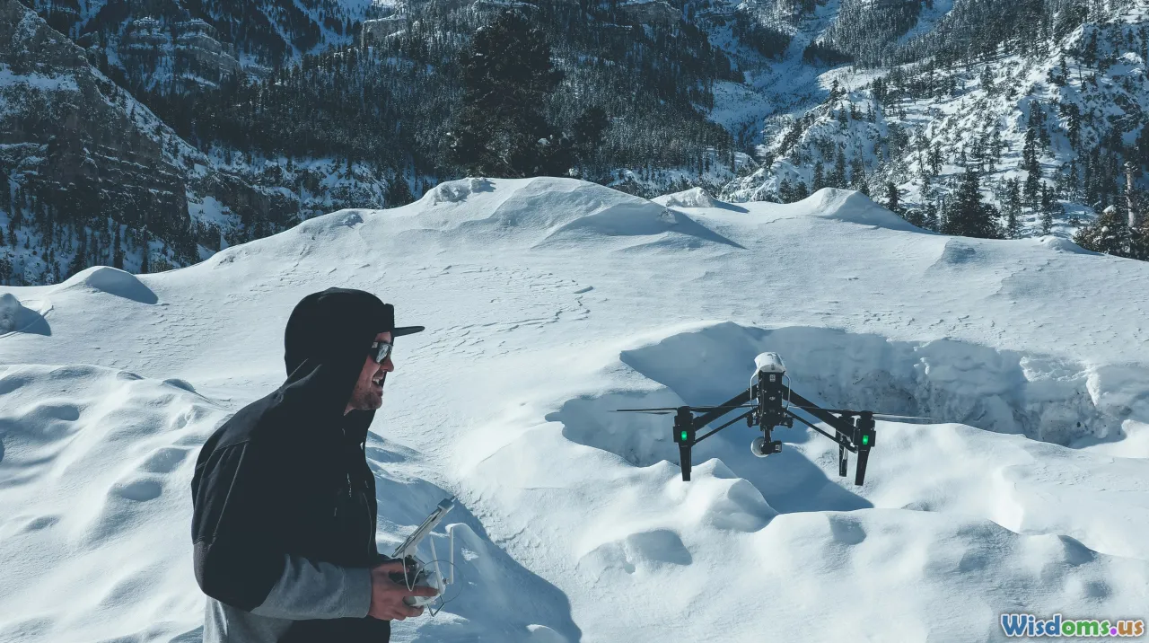
Aerial Drones Underground
Although drones are typically associated with open skies, engineers have developed compact models capable of navigating low-light, GPS-denied environments. Drones like Flyability's Elios series utilize protected, spherical cages and collision-tolerant sensors to fly in tight passageways, mapping and sampling where humans cannot venture.
- Case in Point: In 2023, the British Cave Rescue Council deployed Elios drones to investigate an unknown shaft in Wales, where water and loose rock made human entry unsafe. The drone relayed video and atmospheric data, identifying hazards and possible passageways without risking a single life.
Robotic Crawlers and Swimmers
Ground-based robots—some the size of a toy car, others resembling limbless snakes—carry cameras, temperature and humidity gauges, or even tiny robotic arms. The National Institute for Astrophysics in Italy tested a “caver robot” able to squeeze through fissures a human skull would never fit, crucial for systems prone to collapse or where rich mineral deposits await study.
Underwater Explorers
Flooded caves, or “cave diving,” is among the world’s most dangerous activities. Autonomous underwater vehicles (AUVs)—such as the OceanOne robot developed by Stanford—can explore submerged cave tunnels inaccessible to divers, bringing back critical information and beautiful three-dimensional renderings without human risk.
Smart Wearables and Real-Time Life Support

Safety and survival have long depended on preparation and intuition, but even the best cavers cannot account for every variable underground. Recent advancements in wearables are shifting that paradigm: putting biosensing and instant communication literally onto the body.
Cutting-edge Helmets and Fitness Trackers
Modern cave helmets now incorporates LED arrays, cameras, and real-time communication links. Integrated sensors monitor heart rate, SpO2 (blood oxygen saturation), and CO2 levels—warning wearers if air quality drops or signs of hypothermia appear. Sunto's GPS watches, adapted for caving, can log progression, even underground, syncing with surface teams through mesh networks.
- Example: After a cave-in during a 2021 Slovenian rescue mission, helmet-worn biosensors allowed surface coordinators to observe rescuers' vital stats, triggering targeted snacks and heated rest intervals that prevented exhaustion.
Smart Textiles
Imagine base-layers that warm or cool automatically, depending on the wearer’s vital signals or ambient cave humidity. Companies like Hexoskin are prototyping smart shirts for caving expeditions, promising resilience in conditions that swing from freezing cold to torrid heat just meters apart.
Data-Driven Decision Making and AI in Cave Science

Continuous data recording is churning up an avalanche of information about gravity, humidity, airflow, and biodiversity inside caves. Artificial intelligence (AI) stands to revolutionize how that data is analyzed, visualized, and applied in real time.
Predicting Geohazards
Machine learning algorithms digest multi-sensor data to anticipate cave-ins, groundwater movements, and even shifts triggered by adjacent construction or mining. In Mexico, researchers at the National Autonomous University built an early-warning system that combined seismic sensors and AI to alert explorers to imminent collapses minutes in advance—a lifesaving improvement over traditional ‘feel and listen’ intuition.
Biodiversity and Microbial Analysis
Caves are rich laboratories for extremophile life—including bacteria with the potential to yield new antibiotics or industrial enzymes. AI-powered image recognition is used to classify tiny organisms from in-cave imagery, cutting analysis time from weeks to minutes. DARPA’s Subterranean Challenge included a task where AI-software scanned robot-captured images to flag signs of life or archeological significance, supporting rapid triage and collection during limited access windows.
Enhancing Collaboration
Datasets can now be shared in near real time with researchers around the world through cloud-based portals, facilitating cross-disciplinary research (e.g., geology, biology, rescue logistics). As neural network-driven predictive models mature, they will further reduce risk by identifying likely passageways and hidden chambers previously invisible to the naked eye—or missed in hand-mapped blueprints.
Sustainable Exploration and Conservation Efforts
With new access come new responsibilities. Modern tech does more than propel cavers deeper—it also offers tools to tread lightly on fragile subterranean ecosystems.
Remote Monitoring of Sensitive Environments
Miniaturized, wireless sensor networks (such as motes powered by piezoelectric vibrations) are now installed at cave entrances and along critical passageways. These record footfall, temperature, humidity shifts, and vibration, allowing conservationists to monitor in real time the biological stress on bat populations or sensitive mineral features. This data shapes restricted access policies and visitor guidelines.
- Case Study: In Slovenia's Škocjan Caves, UNESCO managers use autonomous sensors to detect changes in air composition and flow patterns caused by tourist surges, guiding decisions on group size and schedule. Over five years, this tech-driven management halved the rate of stalactite degradation and prevented new micro-erosion zones from forming.
Non-Invasive Research Techniques
Traditionally, sampling or research required physical disturbance (e.g., scraping cave walls or harvesting organisms). Today’s non-contact methods—such as portable XRF for elemental analysis or handheld hyperspectral imagers—allow researchers to ‘see’ into the rock or sediment without extracting a thing. This is preserving both their scientific value and their natural wonder for future explorers.
Reducing Human Impact
New materials for gear (biodegradable ropes, ultra-light latticework boots) and more efficient power sources (like solid-state batteries with six-month shelf life) mean expeditions leave less waste behind, further reducing their ecological footprint.
Democratizing the Underground: Remote Access and Citizen Science

Not everyone will rappel into the abyss or squeeze through contorted crawlspaces. But emerging tech is opening cave worlds to a vast, virtual audience—and empowering citizen scientists as partners in discovery.
Virtual Reality (VR) and Public Exploration
Institutions like France’s Lascaux Cave Museum use VR and massive LED wall replicas to let millions “walk” through prehistoric galleries that can no longer withstand human presence. Real, high-resolution scans—converted into VR journeys—put exclusive places within reach without a single muddy boot.
- Tip for educators: Programs using VR can teach geology, biology, and anthropology in an immersive, hands-on format—especially valuable for schools far from major caving regions.
Crowdsourced Data Analysis
Open map projects, such as the Chauvet Cave’s ongoing 3D reconstruction, invite volunteers to help mark points of interest, transcribe data, or flag anomalies. Apps like iNaturalist are equipping recreational cavers to photograph, log, and identify cave-dwelling insect and fungus species, creating enormous biodiversity datasets for academic study.
Social Media and Live Stream Integration
Some teams live-stream explorations using low-light cameras and portable satellite uplinks, bringing the excitement—and crucial safety oversight—to larger networks. The result: a blend of professional expertise and public enthusiasm, recruiting a new generation of cave stewards.
Challenges and Ethical Dilemmas: What Tech Can’t Solve (Yet)

Despite surging possibilities, significant obstacles and ethical questions remain on the path toward fully tech-driven cave exploration.
Gear Dependence versus Human Skill
Tech is only as good as its weakest link. Gear can fail: batteries run out, electronics succumb to damp, robots wedge themselves irretrievably. Responsible caving still demands a robust skillset—navigation, ropework, first aid. Training is shifting to blend digital literacy with all-weather, no-power survival capability.
Data Security and Ownership
Who owns the high-value scans of a previously undocumented cave chamber—especially if that site holds indigenous art or possible mineral wealth? The issue is pressing in places where digital leaks could lead to looting or over-tourism. National agencies and caver organizations are rapidly drafting new ethical guidelines, but consensus is still forming.
Preserving Mystery and Managing Access
Some argue that the mystique of unexplored caves—a vital pull for explorers and conservationists alike—may be diminished by complete virtual tours or public datasets. The old cultural quarrels about revealing the locations of wild caves continue, heightened by instant global sharing. Striking a balance between open science and prudent silence is one of the most delicate new challenges facing the field.
A New Era Just Beginning

It is paradoxical: as humanity exhausts the grand surface frontiers, caves—timeless and dark—beckon as one of the last truly mysterious shelters on Earth, and perhaps on other worlds as well. Mars and the Moon hold lava tubes likely prime for future missions; today’s research is laying groundwork for tomorrow’s planetary explorers.
Technology will continue to unlock new physical and intellectual gateways: from ever-sharper sensors that see through stone, to global, real-time networks of explorers (both human and robotic), and virtual platforms democratizing access. Yet, it will always be the combination of humans and their tools, courage informed by data, and respect for these delicate hidden worlds, that defines the next age of cave exploration.
In the years to come, the caves themselves will write new chapters of science and story, with technology—and those who adeptly wield it—serving as both chroniclers and stewards of subterranean wonder.
Rate the Post
User Reviews


Popular Posts